Recent Project
I received a grant from the Marie Skłodowska-Curie H2020 Fellowship program at the 2019 call. My 2 years fellowship took place in the CERTEC group of the Universitat Politecnica de Catlauna from October 2020 to October 2022. A specific website was dedicated for this project: 3dfirelab.eu .
Examples of some of my Research
in Remote Sensing
November 2017: Estimating Digital Surface Model from UAV borne visible images to calculate vegetation volume. 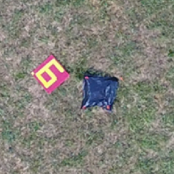
April 2015: Presentation of an algorithm which extracts from the MODIS archive several products from multiple overpasses of the same fire. 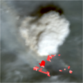
June 2014: Example of georeferenced thermal and visible images collected from a helicopter hovering above a prescribed burn. 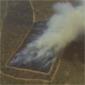
September 2011: synchronized visible and Middle Infra Red cameras operated from a helicopter hovering above a prescribed burn of slashed trees representing typical deforestation activities. 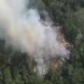
March 2010: Example of georeferenced Middle Infra Red images from a small scale fire. 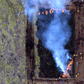
in Modelling
July 2023: test. 
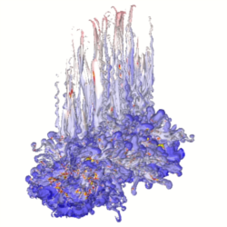
June 2016: Large Eddy Simulation using ForeFire-MesoNH fire-atmosphere system for a 7ha prescribed burn with convective fluxes computed from overhead thermal images.. 
December 2015: Development of a fire plume model with inputs from remote sensing products for implementation in large scale chemistry transport model.. 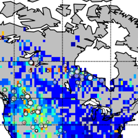
May 2008: Numerical simulation of a condensation trail evolution and its interaction with the atmospheric turbulence.